Calgary Flood – 2 years later. Where are we now?
It has been 2 years since the 2013 Calgary floods that occurred in Southern and Central Alberta. What’s changed?
Overland Flood Insurance Availability
In 2014, Canada’s Economic Action Plan noted that “Canada is the only G-8 country without residential flood insurance coverage, leaving many Canadian homeowners with inadequate protection against losses from overland flood events.”
In 2015, Canadian insurance providers began offering overland water protection for residential property owner across Canada.
Aviva Canada was the first to introduce this change to the market followed shortly after by The Co-operators with Alberta being the immediate focus and other subsequent provinces to be rolled out over time.
A better understanding of flood risk
According to the Canadian Underwriter:
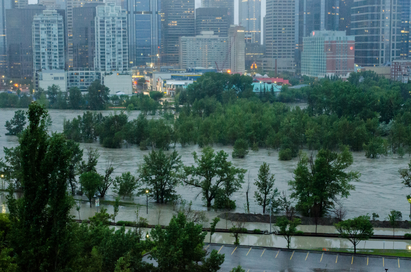
Flooding is the most common type of natural disaster in Canada and the flood in southern Alberta in 2013 was the most costly storm in Canadian history. “In general,” overland flooding is not currently covered on home insurance policies, the Insurance Bureau of Canada said recently on its website.
A number of vendors have begun to offer hazard maps that help companies determine
The first vendor to market was JBA Risk Management and in May 2015 Aon Benfield began offering this type of data to Canadian insurance companies.
A better understanding of portfolio risk
As the usage of flood hazard maps increases, they will also seek detailed property location information to ensure that they understand where current and new customers are located in reference to these boundaries.
Insurance companies typically utilize three (3) different boundaries from the first three digits of the postal code to the address when analyzing flood risk:
| Boundaries | Number of unique records in Canada 2015 |
| Forward Sortation Areas (FSA) | 1.6K |
| Postal Codes (FSA LDU) | 857K |
| Addresses | 15M |
Address level accuracy should be considered when mapping (geocoding) your portfolio against flood hazard boundaries versus the use of postal codes to better understand risk. Using postal codes without understanding how many individual properties are associated to it in relation an event boundary may lead to the stigmatization of that entire postal code even though only a few addresses may be impacted.
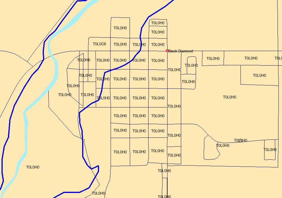
Below is an example for the municipality of Black Diamond, Alberta which has one postal code (T0L0H0) and over 1,000 addresses associated with it. The blue boundary represents the flood boundary from the Alberta 2013 floods.
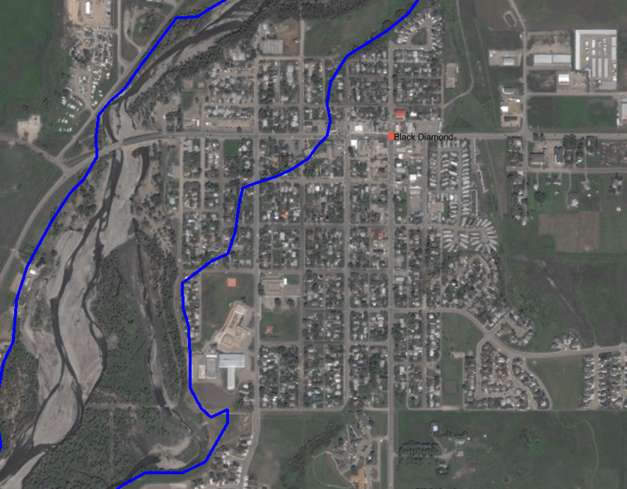
The map below depicts the same area where the blue boundary represents the flood boundary from the Alberta 2013 floods:
Data maintenance is essential to ensuring high-precision accuracy.
| Alberta municipalities | Number of new addresses added since 2014 |
| Calgary | 31,897 |
| High River | 281 |
Address level precision should be utilized when comparing flood information to policies and performing other forms of analyses such as concentration analysis and proximity to other perils such as risk (e.g., underground tanks).
Click the links below to learn more about disaster risk management and disaster visualization tools:
To learn more about how your book of business may be impacted by overland flood in Canada, please contact us.


