Smart City GIS Platform

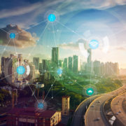
What Does it Mean to Be a Smart City?

As cities around the world embrace the changes wrought by digital technologies, there’s still a lot of confusion about what it means to be a smart city. Generally characterized as an urban area that uses data and technology to improve operational efficiency, smart cities promise to enhance how people relate to their environment.

Smart cities are developed by technologists and urban planners who gather and analyze information to improve problem areas. These can include traffic, pollution, public safety, public health and wellness, sustainability, and much more. Institutions like schools, hospitals, power plants, and waste management are able to use data to optimize operations and operate quickly and efficiently.

Being a smart city can mean many things and it can look very different depending on where you are, but the objective is always the same – using technology to create a sustainable future and improve people’s quality of life.

Smart City Technology is Here

Smart cities feature a combination of technologies including the Internet of Things (IoT), artificial intelligence (AI), mobile technology, networks of embedded sensors that read and respond to data, the semantic web, and many other platforms that interface with one another. These technologies are employed to gather actionable data and improve efficiency.

Examples of smart city technologies include alerts to help people find parking more easily, or the ability to change traffic patterns in real time to respond to peak congestion. It can include systems that monitor air quality in buildings and automatically engage air purification systems when necessary, or systems that automatically harness natural sources of power like wind and solar energy. Smart city technology can even help preserve resources by detecting gas or water leaks, instantly sending alerts to engage the appropriate department.

Effective Communication Between Government and Residents

Most government agencies, whether municipality, federal or provincial, struggle to effectively communicate with residents. Smart city technology aims to solve this problem by finding new ways to engage with residents to more easily understand their needs and serve them more effectively.

Digital mapping is an example of how many governing agencies engage technology to communicate more efficiently. Digital mapping provides a platform to easily integrate, consolidate and analyze data quickly to monitor assets and streamline workflows for great efficiency. It’s a simple way to provide visual information to residents about their community, while also offering them the ability to input observations and experiences and get feedback in real time.

Prevent Problems and Hazards Before They Happen

A major benefit of the data cities gather using smart technologies is the ability to generate predictive analytics to improve safety and identify problems before they happen. Spatial technology plays an important role here, providing accurate, updated hazard data to monitor and identify risks quickly.

An example of this is the ability to monitor for the likelihood of fire by using spatial technology to review various data points layered onto a map. This information can easily illustrate new construction, or older buildings that haven’t been updated to meet current safety codes and standards. These areas could serve as a potential warning in need of being carefully monitored to mitigate the risk of fire.

Smart Cities are Growing

With current estimates showing that 70% of the world’s population will live in cities by 2050, measures to improve safety and sustainability are critical. Growing populations put pressure on government agencies to ensure cities are functioning at optimal levels.

Whereas smart city technology was once pegged for large cities, urban areas large and small are instituting digital technologies to optimize operations. The International Data Corporation projects that smart city investments will reach $80 billion in 2018 across a range of communities throughout the world, and is likely to grow to $135 billion by 2021. Investments include data-driven public safety initiatives, efficient energy, sustainable infrastructure and much more.

We can expect some major innovations for the future of smart cities, including an increase in video surveillance with monitors that can respond to queues and alert the appropriate authorities when needed. We can expect greater sustainability, and the ability to more efficiently monitor precious resources like energy and water. More than anything, these changes promise a happier, healthier future for people around the world.

Interested in learning more about becoming a smart city? Download our guide here.

Smarty City and Location Data

6 Characteristics Smart Cities Should Look for in a GIS Platform

  1. Customization

    Look for an integrated customizable solution that works with Regional Municipalities, Local Council Authority (LCA), Local Municipalities, or your agency’s framework. This means you are in complete control of what is shared and how feedback is received.

  2. Relevant Information and Usability

    Make sure the platform provides intuitive and user-friendly access to data. In the past, data overload has been an issue. Employees would have to expend a lot of time and energy weeding out the useful information from the noise. Likewise, the public may be looking for specific information and be forced to comb through all the available data layers to obtain the information they seek.

  3. Improved Productivity

    Pick a platform built for all users. Avoid the scenario where one employee has to become expert at accessing the data or answering the same questions from multiple constituents. This way you can avoid frustration by constituents trying to find an answer and not finding a person who can help. With the right technology partner, there is no GIS expertise required to implement and tailor a solution.

  4. Security

    Focus on a secure solution. The platform used should be secure and follow established encryption guidelines.

  5. Reliability

    Make sure the platform is reliable so you can be assured of access when you need it to. Make sure the data is updated in real-time and that the updates are delivered seamlessly, ready for you to start using immediately.

  6. Maintenance

    Look for a platform that is easy to maintain. Data integration used to be a huge effort when it came to maintenance. Each agency or department was required to have dedicated servers to contain the data and run the platform. This allowed for greater likelihood of platform interruption if one of the servers went down. It also had a budgetary impact for additional staff and equipment needs to keep the platform running, during a time when every penny is counted and stretched as far as it could go. With the right platform, you can transfer the maintenance stability and costs to a single vendor so your agency can do what it does best.

No matter where your city is on the transition timeline to becoming a smart city, your use of this checklist is either a first step or a continuing step forward. If you have questions about how your city can get started or what role GIS technology can and should play in your progress, please get in touch. Your community and your fellow city employees will thank you!

Use this checklist to help your team learn what 6 characteristics to look for in a GIS platform.

Contact us to learn more.

IoT and Location Intelligence

5 Industries Being Transformed by IoT and Location Intelligence

Read to learn how the fusion of location data with the Internet of Things (IoT) is making organizations smarter and more efficient across industries

So many devices around us have steadily gotten connected to the Internet that we hardly even notice how extensive the Internet of Things (IoT) ecosystem has become. Our computers and smartphones may be the most obvious IoT players, but today, everything from household items to manufacturing machinery has been embedded with sensors which are generating and streaming data without any kind of human intervention.

Given this pace of proliferation, Gartner says we should expect to see more than 20 billion Internet-connected devices by 2020. And McKinsey maintains that IoT applications could have a global economic impact to the tune of $3.9 trillion to $11.1 trillion per year by 2025. These incredible figures start to sound all too plausible when you look at the developments closer home.

According to IDC Canada, over 45% of Canadian organizations today have dipped their toes in the IoT pool and the IoT market in the Great White North alone is predicted to reach a value of $13.5 billion by 2019. When you consider how IoT is giving businesses access to knowledge they could never tap into before, the optimism for IoT applications gets more than justified.

IoT sensors generate a massive amount of data every day. To both increase revenue and decrease costs, all companies need to do is know how to extract actionable insights from the information at their disposal. Many industries have discovered that the best way to do that is to tie disparate information streams together using an easy-to-recognize context called location.

By using precise location data, organizations can easily visualize what is happening where. And by analyzing historical data bound by spatial awareness, they can map trends and use these insights to optimize business processes.

Let’s dig a little deeper into how various industries are becoming smarter and more efficient by fusing IoT with location intelligence:

Smart Cities

Urban analytics is an essential component of smart city development. IoT and location intelligence are allowing governments and municipal agencies to quickly gather regional insights to identify inefficiencies as well as environmental impacts and risks. For instance, smart sensors on wheels can not only identify most congested areas, they can also provide a telling picture of pollution hotspots. Further, IoT and location intelligence are also creating ladders of opportunities for businesses. For example, the Canadian city of Mississauga publishes its real-time bus locations as a live open data set. A gallery can easily use that information to tell a commuter about an art exhibit they could visit at the next stop.

Supply Chain and Logistics

The marriage of IoT with location intelligence is bringing greater levels of transparency and efficiency in the supply chain, and changing the playing field for organizations that deal with logistics. Embedding tags in cargos is leading to an unprecedented ease in asset tracking and tracing – both during in-freight operations and at the time of inventory management in a warehouse. Distribution centres are also able to manage their yards more effectively by providing up-to-the-minute directions to truckers based on the type of goods they are carrying. And businesses even have an opportunity to provide early intervention in case an asset goes missing or is out-of-place.

Consumer Retail

A study undertaken by Deloitte and the Retail Council of Canada has found that retailers are using smartphone-based traffic analysis to understand the foot traffic outside and inside stores during different times of the day. This data is helping retailers to implement strategies to grow in-store traffic at preferred times. But that’s not the only way how location intelligence and IoT are transforming consumer retail in Canada. Retailers are also using these technologies to execute everything from offering in-store navigation to identifying profitable locations for new stores.

Insurance Companies

According to PWC Canada, 63% of insurance CEOs are convinced that IoT will be strategically important for their organization. And location intelligence is a natural fit for this bundle. Sensor data backed by spatial awareness can give insurance providers first-hand information about what happened, improving their ability to proactively address claims. Insurance companies can also use the location-backed data to improve their risk rating, detect fraud, and improve customer loyalty. For instance, a car insurance provider can offer discounts on premiums to its customers based on their real-time driving data.

Energy and Utilities

Providing reliable, high-quality and uninterrupted service requires a great amount of visibility and control across the entire utility network. IoT and location intelligence make that possible in ways more than one. Peterborough Utilities Group in Ontario, Canada efficiently manages outages and voltage discrepancies in its distribution network by using IoT to capture multiple data points like temperature, board status, etc., every few minutes from its metering points. Meanwhile, BC Hydro, the chief electric utility for British Columbia, has found that it can restore power faster and isolate faults to the smallest possible area leveraging an IoT-based smart grid system.

Clearly, location awareness is indispensable for an effective IoT network. Location intelligence can provide both context and relevance to an organization’s decisions supported by sensor data and open up a wealth of opportunities for smarter growth.

To know more about how you can benefit from adding precise location data to your IoT setup, contact us.

Additional Reading: