Geolocation

How Geolocation changes Marketing

By Robert Szyngiel, DMTI Spatial

What do Starbucks, Whole Foods, Taco Bell and L’Oreal have in common? They are among the first wave of brands to dip their toes into the geolocation pool. By recognizing the power of location as a strategic marketing tool, these companies have demonstrated that it can be leveraged to successfully boost customer acquisition and retention.

So, what is geolocation-based marketing? It refers to using individuals’ exact physical locations – which are received via their GPS-enabled mobile or wearable devices – to push out highly relevant and personalized messaging, including advertisements, discount coupons and promotions.

A core direct marketing technique, geolocation is all about building intent-based relationships. If you are aware of the location of a prospect you can use other known parameters, such as their occupation, age and interests to determine what they are doing at that location and send out messaging to drive them toward your business.

Not surprisingly, one of the key requirements for geolocation to work as an effective marketing strategy is the willingness of consumers to share their personal information with businesses. So as long as businesses supply genuine value-addition to their customers there is no good reason for them to ignore the vast and untapped potential of geolocation. After all, geolocation-based marketing helps companies to not only recognize their customers but it also equips them to interact with those customers in real time.

Geolocation is transforming the marketing landscape

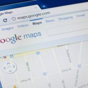
Marketers are no stranger to location-targeting offered by major ad platforms like Google AdWords or Bing Ads. But this feature only skims the surface of what geolocation can do for businesses.

Here are several ways in which you can expect geolocation to change marketing:

Data-driven marketing

Customers like brands that “get” them. They stay loyal to businesses that understand their exact requirements: which cannot be achieved without continued access to accurate data. The need for building precise customer profiles means more companies are going to invest in data-driven marketing;  A location-based framework is an ideal way to map existing customers in relation to your own stores or that of your competitors. Having reliable data also comes in handy while identifying potential customers located in the proximity of the existing client base. And when you are looking for important trends and patterns to help with your marketing strategy, having correct addresses guarantees direct mail cost savings. For example, if you know which communities have French-speaking customers you can channel French-language messages to them and drive them to your nearest store

Improved app engagement

Many businesses have their own apps, providing a quick and convenient way to access the geolocation of any customer who has consented to location data-sharing. By erecting virtual fences (a.k.a. geofencing) around stores or sites companies can push out highly personal and relevant messages to the customers who are present within those specified areas. Starbucks uses this technique to distribute discount coupons to its patrons for use at nearby stores.

Similarly, companies can also use geolocation to enhance the customer experience. For example Taco Bell allows customers to place their orders via the mobile app and then tracks their locations to ensure that when the customers arrive at the stores their food is hot and ready;

Predictive alerts

What happens when you give geolocation a booster shot of machine learning and artificial intelligence (AI)? You get predictive alerts that take personalization to an awesome new level. By studying a customer’s in-app behaviour or analyzing their historical shopping data, predictive algorithms can determine when a patron is most likely to be near the location of a store and send out offer alerts accordingly.

Since this marketing technique is most effective when the customer has not decided to buy but is likely to, companies can fuse it with a “remind me” element, wherein a customer can ask the app to remind them of the offer at a particular time. For example, a brewery can push out a deal in the morning if it notices a trend of customers visiting pubs on Fridays. And to solidify the intent, the app can also offer to remind customers of the discount deal again at 5 pm, when they are most likely to be leaving from work;

Geo-conquesting

An offshoot of geofencing, geo-conquesting refers to attracting customers away from the competition when they are near a competitor’s location. Whole Foods has effectively deployed this technique to lure customers away from competing supermarkets. By strategically offering customers better deals in exchange for travelling to a nearby Whole Foods store, it is able to influence patrons’ buying decisions in its favour. There are no reasons why other businesses will not be seen replicating this success in the near future;

Managing micro-moments

According to Google, micro-moments are intent-rich moments that occur “when people reflexively turn to a device —increasingly a smartphone — to act on a need to learn something, do something, discover something, watch something, or buy something.” This kind of customer behaviour has made it imperative for businesses to be ready with the most relevant information when the “moment” strikes.

Geolocation plays an indispensable part in managing this on-demand economy, for when people look for a restaurant, a convenience store or any other business, they want one that is “near” them. Expect to see successful companies leverage geolocation in novel ways to get in front of their customers during these moments and knock out the competition; and

Augmented Reality

Augmented reality (AR) is a new geolocation technology trend that leaves an indelible impact on customers. AR refers to the overlaying of technology-based elements on real, physical surroundings of a person to create a virtual world of sorts. L’Oreal has been an early AR adopter, with one of its events showcasing virtual artworks to customers depending on their physical locations at the event’s site. Expect AR to create new waves in marketing as more companies realize how they can use location technology to give incomparable product demos to patrons. For example, a furniture store can show you exactly how a new table would look inside your living room.

In conclusion, so, while there is no doubt that geolocation is all set to revolutionize the way companies market, they will need a solid hold on the geolocation business, arming themselves with the right data and tools that would allow them to implement an effective geolocation-based marketing strategy.

Robert Szyngiel leads product management at DMTI Spatial, a Digital Map Products company. For more information on DMTI Spatial, visit www.dmtispatial.com, and for information on Digital Map Products, visit www.digmap.com.


Additional Reading:  


Digital Maps Google

How retailers can use digital maps to improve customer experiences

By Robert Szyngiel, leader, product management, DMTI Spatial

Digital maps have become an indispensable part of our daily lives.   According to a recent Alpha Beta study commissioned by Google, $1.2 trillion of sales worldwide can be tied to digital maps.

But while you may know how much easier maps have made your life, let’s take a look at three ways that retailers can use digital maps to improve customer experiences:  Read More 


Additional Reading:  

Leverage Location Insight geofencing

5 Creative Ways Marketers Can Use Geofencing

Location-based marketing is clearly on an upswing, with more and more marketers leveraging location intelligence to support marketing initiatives. Geofencing is a powerful way to locate and market to high value customers, boosting brand visibility and customer engagement.

What is Geofencing? Geofencing is the use of GPS, bluetooth or radio frequency (RFID) to designate a virtual geographic boundary around a specific area. The system is triggered in real time when people enter or leave the ‘fence,’ and can be used to communicate with people in the fence via text, email, or notification.

How Marketers Can Use Geofencing

Geofencing is the use of GPS, bluetooth or radio frequency (RFID) to designate a virtual geographic boundary around a specific area. The system is triggered in real time when people enter or leave the ‘fence,’ and can be used to communicate with people in the fence via text, email, or notification.

  1. Competitive Insights  

    You can conduct trade area analysis by placing geofences around competitors to reveal how often your customers visit them, and what sort of foot traffic they tend to get. Pair this with analysis of your competitor’s deals and incentives to learn how they drive traffic, and apply that knowledge to creating better offers for your customers.

  2. Incentivize Customers 

    Deliver limited time offers when customers enter your fence to incentivize them to visit your store. You could also offer an extra deal when you need to boost traffic in a part of your store that might be struggling to make sales. For example, use a push notification to alert of a deal in a low-traffic zone, encouraging customers to check it out. Bonus tip: Place a fence around a nearby competitor’s store and send an incentive for your store to draw them back to you.

  3. Collect Intelligence 

    Geofencing is a great way to gather information on your customers and get a better understanding of your customer base. You can get a sense of how often they visit, the most popular times, and what sort of deals incentivize them to come. You may even get a sense of who your most loyal customers are, and leverage that information by asking them to become a brand advocate or provide a testimonial.

  4. Target Like-minded Crowds 

    Do some research about where your target audience tends to hangout, and place a geofence around that area to target like-minded crowds. Send timely communication to let that crowd know what your company has to offer. For example, maybe you own a store that sells camping equipment. By placing a geofence around the parking lot of a hiking trail, you can target people who are likely interested in what you have to offer.

  5. Make it fun! 

    There are a lot of ways to get creative and use geofencing to engage your customers in fun ways. Create games or trivia that are triggered when customers enter your fence. Maybe winning a game provides them with an extra discount or bonus. Or consider creating geofilters that customers can use when they’re in your fence, and that can be easily shared on social media.

Geofencing can help you engage customers in powerful ways. Using the tactics above, you’ll be able to hypertarget customers with content that is very specific to their needs and consistently keep your company top of mind.

Learn more by downloading our Ultimate Guide to Using Location Based Insights for Omnichannel Marketing


Location Intelligence and Advertising

4 Ways Advertisers use Location Intelligence to Identify Effective Ad Space

With all of the platforms available for advertising today, marketers have to find the most effective way to reach customers and craft messaging that is consistent but also aligns with the platform that message is being delivered on.

While mobile devices provide insights on how people behave online, location technology offers insights on what people do offline by showing their physical location, when they are digitally connected but not actively engaging in online activity. Aggregating online and offline behavior is incredibly powerful when developing advertising campaigns.

Here’s an overview of how location intelligence applies to various marketing channels:

Online/Social Media Ads:

This refers to digital and mobile ads on social media, search advertising, Adwords, etc. By adding designated locations to digital ads, you don’t waste money on clicks from customers outside of your specified location. Combined with geotargeting and geofencing, you can develop very specific ads based on consumer behaviour and intentions.

Print/TV/Radio/Podcasts:

While these four ad segments are quite different from each other, they are lumped together here because they all have very precise information about their audience that they will share with advertisers. However, location intelligence gives you an edge over other advertisers by helping you leverage offline behaviour to craft very specific messaging to your target audience.

Billboards:

Location intelligence platforms provide continually updated demographic data. Use demographic insights along with geotargeting to gather information about highly concentrated locations of your target market to determine the most effective placement of billboard advertising. DDGuerilla Advertising/Marketing: This is the most unconventional form of advertising, but can be the most impactful if done right. For example, if you’re a company that heavily targets women between the ages of 26-40, you can use your location intelligence platform to identify an urban area with a high percentage of female employees. Setting up a guerilla campaign for a couple hours during lunch time could be a hands-on way to get directly in front of your target audience.

Guerilla Advertising/Marketing:

This is the most unconventional form of advertising, but can be the most impactful if done right. For example, if you’re a company that heavily targets women between the ages of 26-40, you can use your location intelligence platform to identify an urban area with a high percentage of female employees. Setting up a guerilla campaign for a couple hours during lunch time could be a hands-on way to get directly in front of your target audience.

Omnichannel Marketing:

Putting it All Together With the location-based insights you’ve leveraged to determine effective ad space, you can also determine how to integrate your marketing initiatives to ensure all ad spaces support each other. For example, use social media and radio ads to draw attention to an upcoming guerilla marketing initiative. Or develop consistent messaging for print, TV/Radio and billboards to draw attention to a major new product offering for people in a specific area.

Everything is dependent on your business or company’s specific use case, but these examples show how you can leverage location intelligence to see where the most impactful ad placements are by allowing you to gather online and offline information about your target market. Location intelligence will help you determine which ad spaces will be more effective for you, and will provide information about how to craft consistent messaging for each channel.

Want to learn more?  Read our Ultimate Guide to Using Location Based Insights for Omnichannel Marketing


Additional Reading:

GIS Day DMTI Spatial

Celebrating GIS Day

Did you know there is a GIS day to celebrate the impact of GIS technology around the globe? Today is GIS Day, and at DMTI Spatial we see this as a great opportunity to share our knowledge of the role Canada has played in the development of GIS as a technology that has shaped and changed our world in profound ways.

Today, 66% of enterprises rank GIS technology as critical or very important to revenue growth strategies, and many fundamental business practices–even elements of our national safety suc as assisting with emergency responsiveness and preparedness–rely on GIS technology.

What is GIS Day?

GIS Day started in 1999 as a movement launched by Esri to encourage people to learn and share knowledge about the widespread impact of GIS technology. The movement has grown over the years, and today GIS Day has a Facebook group with 18,000+ members!
GIS Day provides a forum and an opportunity for GIS experts to demonstrate the real-world applications of this amazing technology and how it makes a difference in our society. Every map has a story, and GIS Day is the time to celebrate those stories.

Canada and GIS Day

Canada’s history is rich in technological achievements, and is a pioneer in the development of GIS. Many of the methods and techniques used by GIS specialists throughout the world were developed or conceptualized by Canadians.
Here are some examples of how Canada has contributed GIS technological innovations:

  • Dr. Larry Morley: Widely considered a remote sensing pioneer, Dr. Morley is remembered for starting the remote sensing program in Canada. He was the founding Chairman of the Canadian Remote Sensing Society in 1974, and in 2015 he was inducted into the Canadian Science and Engineering Hall of Fame.
  • Dr. Roger Tomlinson: Known as the ‘father of GIS,’ Dr. Tomlinson worked for the Ottawa-based survey company Spartan Air Services. It was here that he conceptualized the idea of combining land use mapping with computer technology, and became central to the development and eventual applications of GIS technology.
  • RADARSAT: This Canadian-based remote sensing Earth observation satellite is an advanced satellite system providing high quality, accurate images of the earth for a wide range of uses–one of which of course is integration with GIS technology.
  • Geomatics: This fundamental GIS term was introduced by Michel Paradis, a French-Canadian surveyor, during a keynote address to the Canadian Institute of surveying in 1982. He argued that mapping tools would need to innovate alongside the pace of technology to truly address modern mapping needs. The phrase ‘geomatics’ became the accepted umbrella term for the tools related to mapping technologies.

GIS Technology in Canada Today

Many Canadian companies and scholars continue to push GIS technology forward, often with support of various government programs. Geospatial technology is critical to the functioning of many technologies people have become dependant on, including mapping applications, sensor technologies necessary for the Internet of Things (IoT), and Artificial Intelligence (AI).

The Canadian Geospatial Data Infrastructure (CGDI) is supported by the Canadian government, and is the source of “standards, policies, applications, and governance that facilitate the access, use, integration, and preservation of spatial data.” GeoConnections is another national program mandated to lead CGDI through the use of standards-based technologies and operation policies for data sharing and integration. This program is incredibly important, as it ensures that quality GIS technology is accessible to the people who need it.

DMTI is Canada’s Leading GIS Technology Provider!

Canadian people and companies will continue to make major contributions to the advancement of GIS technologies throughout the world. Here at DMTI we are proud contributors to Canada’s GIS past, present, and future.

Founded in 1994, we knew early on that the power of location could serve many business sectors including finance, insurance, telco, government, retail, and marketing. DMTI introduced CanMap, the first coast-to-coast digital street map in Canada! As GIS technology became more sophisticated, so did we, adding data to maps, finding unique and innovative ways to serve Canadian businesses.

Contact us today, and learn how DMTI Spatial can help your business grow!

Route Planning with CanMap

Halloween 2.0 with CanMap: The Guide for Serious Trick-or-Treaters!

DMTI is taking Halloween route planning to the next level. Never imagined you could optimize trick-or-treating? Well think again– CanMap makes it happen! Want the biggest candy bars? The safest route? To get as much candy as possible in the shortest amount of time? We’ve got you covered. This is trick-or-treating 2.0!

As you know, CanMap is typically used by companies needing to make serious and impactful business decisions. For example, finance companies that need access to complete property data to approve mortgages, or insurance companies that leverage location intelligence to develop critical insights that help mitigate risk.

In the Halloween spirit, we’d like to show you how the same location intelligence tools that make it easier to identify business opportunities can also take trick-or-treating to a new level. Let’s get started!

Using CanMap to Plan an Optimal Route

This Halloween, we encourage you to take a break from using CanMap to optimize your business operations, and instead to use it for the serious business of making the most out of the holiday. Use data to plan your route, and you’ll even be able to create a detailed map to print out or refer to right on your phone.

Here’s how CanMap, as well as data from additional DMTI partners, can help you achieve your trick-or-treating goals for the best Halloween ever:

Goal: Top-tier Candy

There’s a certain hierarchy when it comes to candy. Snickers, Malteasers, Crispy Crunch bars, and Kit Kats are at the top of the food chain. Second-tier candy includes individually wrapped pieces of gum or hard candies, and of course, the dreaded box of raisins.

There’s no way of knowing for sure what anyone is going to hand out, but you can make the odds work in your favor by using property data gathered from CanMap.

A higher household income and land value suggests a higher probability of getting pricier candy. Here’s some of the data you can pull to create a map of the homes most likely to be giving out the best candy:

  • Household income
  • Land values

Goal: Get Lots of Candy!

If quantity matters more than quality, all you need to do is look for the areas with a higher density of households. CanMap Address Points can be used to illustrate:

  • Property density
  • Apartment buildings
  • Condo communities
  • Retail centers (many retail centers hand out free candy on Halloween!)

Goal: Safe Routes for Trick-or-Treating

Safety is obviously very important especially since trick-or-treating takes place when it’s dark out and there are a lot of young children walking around. You also want to make sure you’re in a safe neighborhood and that there will be plenty of people around.

Here’s the data CanMap provides to help you discover the safest possible route:

  • Traffic counts
  • Neighborhoods away from busy streets
  • Crime rates
  • Vacant land (you don’t want to find yourself in a deserted neighborhood!)

Goal: The Happy Halloween Neighborhood

Part of the fun of Halloween is seeing other people’s costumes and hearing groups of children shout “Trick-or-Treat!!!” It’s just not the same when you’re trudging from house to house by yourself in a quiet dark neighborhood.

The best Halloween neighborhoods are those with a lot of kids around. Here are some data points that can reveal where all the fun is happening:

  • Demographics – look for areas with a high density of families
  • School district boundary maps

Happy Halloween!

By using the strategies we outlined above you’re sure to enjoy top-tier candy well into 2019. Have fun, stay safe, and plan a route that will impress your friends and neighbors.

Click here to talk to a member of our team, and learn how CanMap can help make for a happy Halloween and a successful business!

Location Intelligence

Location Intelligence: Transforming business processes and creating opportunities

Location Intelligence

A telecom operator’s guide to selecting a 5G cell site with Location Intelligence

Learn how telecom operators are beating the competition by leveraging a location intelligence platform.

A public-private consortium has already pumped in $400 million for 5G research in Canada. How are telecom operators moving forward?

The next-generation wireless network, or 5G, is being hailed as a quantum leap in telecommunications technology which will make download speeds 100 times faster than present-day. But 5G is not about streaming 4K movies in a flash alone. The technology will bring major advances in sectors that rely heavily on real-time data (finance, utilities, transportation, public safety, etc.) as well as connected industries like the Internet of Things and self-driving cars.

So, it’s no surprise that the governments of Canada, Ontario and Quebec are joining hands with private companies like Ericsson, Ciena Canada, Thales Canada, IBM and CGI to create a $400-million 5G research fund. This investment will be used to set-up an array of research labs which will test products and services running on 5G networks.

To be clear, 5G mass deployment in the Canadian market is not expected until 2020. This is because 5G requires an infrastructure which is vastly different from past wireless technologies.

5G Infrastructure: Robust and Extensive

5G is fueled by small-cell technology. Its main component is as small as a shoebox and the accompanying hardware no bigger than a refrigerator. This is the same tech that powers 4G, but on a very small scale. 5G requires 10 to 100 times more antenna locations than those needed by 4G or 3G networks, simply because its signals cannot travel as far as old radio frequencies can.

To draw an analogy, imagine 5G as an e-commerce giant. Instead of trying to cater to a wide region with a single central warehouse, it spreads out its inventory into small dispatch units. So, when the holiday season comes and orders go up, it is able to serve customers much more quickly and efficiently. Similarly, in the 5G universe, if one cell site is compromised, other cell sites help to meet the demand.

5G cell site selection

Since Canadian telecom operators will be investing quite heavily into 5G antennas, foolproof cell site selection is a necessity rather than a choice. Here, a location intelligence platform can prove to be a telecom business’ best friend because it can help the business to identify 5G cell sites based on definitive criteria, such as:

Population Density

In order to maximize network coverage and make sure their investment would get the highest possible returns, telecom operators would want to install 5G antennas at places that have a large number of residents. These population clusters can be clearly mapped by a location intelligence platform. Moreover, telecom companies would also get access to detailed insights on population growth trends, which would allow them to future-proof their plans.

Existing Clientele

With network providers racing to take the lead in 5G rollout and adoption, it is imperative for them to know where exactly their existing clients are and upsell 5G to them. Not only can precise location information help make this process a breeze, but network providers would also be able to enhance customer satisfaction and build greater loyalty for their brand.

Demographics

5G is expensive, we have already established that. And even though telecoms may not have finalized the rates at which they will offer the technology to the end consumer, it makes good business sense to invest in the area which houses an affluent population. A location intelligence platform can help telecoms zero down on hotspots of high median income effortlessly.

Points of Interest

Progressive telecom companies know the importance of tapping into points of interest (POI) data to supplement their revenues. A location may be in the suburbs, but if it frequently plays host to large-scale events or music festivals, telecoms would want to make sure their services are available in that area. Visualizing these POIs on the map can help companies make sure they don’t lose out on business from these high-demand sites.

Accessibility

An important factor that simply cannot be ignored while selecting cell site locations to deploy the 5G infrastructure is the accessibility of that place. Uninterrupted service can only be assured if the technical team has uninterrupted access to a cell site. Here, a location intelligence platform can assist by mapping out all possible 24/7 entry and exit options for the crew.

Local Laws

Proper knowledge and understanding of zoning regulations and local laws are imperative for a smooth 5G rollout. Instead of scrambling for information from different sources, network providers can easily use a location intelligence platform to collate various laws, and draw out insights like which sites allow installations for commercial use at the click of a button.

While there is no doubt that 5G is inflaming a technological revolution in Canada, the market is completely up for grabs. It would be interesting to see which progressive telecom operator beats the competition by leveraging a location intelligence platform loaded with rich data and unparalleled insights.

Contact us to learn more.


Additional Reading:

Spatial Technology

How Spatial Technology Makes Great Customer Experiences Part of Your Insurance Company’s Brand

Insurance is a competitive industry, and when everyone is offering the same services for similar value, there’s only one thing that sets you apart: branding. We’ve talked about how spatial technology helps improve customer experience for insurance companies, but did you know a great customer experience could also be part of how your company brands itself? Branding an insurance company ensures customers know you prioritize their satisfaction, and that’s what makes your company unique from everyone else.

A great customer experience is an incredibly valuable market differentiator. Statistics show that companies known for providing strong customer experiences have more loyal customers, stronger word of mouth referrals, higher profits, and better customer retention than companies scoring lower on overall customer experience.

Leveraging the right technologies to support customers is essential. Spatial technology can play a powerful role in branding an insurance company as a leader in providing great customer experiences.

Branding an Insurance Company Using Spatial Technology

Insurance companies know how important it is to provide great customer experiences, but it turns out most of them aren’t meeting expectations. Insurance-Canada recently published an article based on the J.D. Power 2018 Insurance Digital Experience Study, discussing how insurance companies are falling short on digital customer engagement.

The study found 3 key areas where most insurance companies fail customer expectations. Here they are, with an explanation of how a spatial technology platform can help:

Digital Capabilities:

The study showed that most companies have attractive websites, but are lacking in digital offerings such as processing claims, effective shopping and servicing of policies. Modern consumers expect to do everything online, and potential customers get frustrated by what they perceive as a disjointed experience on most insurance websites.

How a Spatial Technology Platform Helps: A strong spatial technology platform interfaces with your company’s website and customer service software to stream current, updated property information that aligns with digital queries. Data feeds into the rules and parameters set by your company’s underwriters. This allows you to automate the digital shopping process from end-to-end.

Lack of Personalization:

Insurers that tailored insurance offerings to customers’ specific needs scored higher in the study than those who did not. These companies are able to offer precise guidance on insurance plans that will best serve the customer.

How a Spatial Technology Platform Helps: Instant access to spatial data helps personalize the underwriting process and insurance offerings by delivering a complete overview of customer portfolios and property information for properties anywhere in the country. This information presents the big picture analysis of a customer’s property ownership history and current needs, allowing you to effectively review risk and offer the appropriate services to serve them with minimal input from them.

Seamless Digital Experience:

Customers want an insurance website that’s easy to navigate and instantly get the information they need in a clear, understandable format. Customers want providers to offer a range of services that can be completed online.

How a Spatial Technology Platform Helps: Spatial technology platforms feed into your company’s software, allowing you to use spatial data for quick and efficient digital services, but also to provide the information customers are looking for. Additionally, spatial data is continually updated, ensuring that customers are working with only the most current, accurate information.

A strong spatial technology platform has the ability to address all of these common customer grievances, while protecting your company’s rules and workflows. This ensures coverage remains consistent with the risk selection and pricing models developed by your company’s actuarial/risk group.

The Right Spatial Technology Platform Helps Digital Engagement

Leveraging customer experience tactics to brand your company and set it ahead of your competition helps you deliver on modern consumer expectations. Spatial technology allows insurance companies to develop engaging, seamless experiences that support what customers want, need and expect.

DMTI is the gold standard for GIS and location-based data in Canada, offering insurers scalable on-demand tools that support real time workflows. DMTI Spatial’s Location Hub® & UAID® is the only solution of its kind in Canada, and supports you company’s risk assessment process by delivering data visualization tools, and data delivery infrastructure to provide high-precision location accuracy.

Click here to find out how DMTI can help your insurance company become known for providing amazing customer experiences.