Posts

GIS Crime mapping app

Toronto Police Launch New Crime GIS Mapping Tool

Mapping data using tools is a powerful way to engage your audience. Today’s announcement by the Toronto Police of a crime-mapping tool is a great example of an interactive, online map to further engage the public. Crime-mapping tools can help solve major crimes by being able to visualize data on a map. Here’s a snippet of the story:

“The set of tools provides interactive mapping of crime information that will give the public up-to-date locations of what’s been happening in their communities,” Ian Williams, acting manager of business intelligence and analytics, said in a release.

Interacting with GIS Data

Data growth is set to continue at a fast rate, with data growing in volume, breadth, and complexity.

GIS has always been a powerful tool to help analysts make sense of vast amounts of information. We now have the ability to make this data available in a way that allows average users to interact and interpret the data. Audiences that don’t have traditional GIS background or experience in mapping can also use these tools.

Many datasets within our enterprises are capable of being mapped, but accurate geocoding, datasets and easy to use visualization tools are the key.

DMTI Spatial Data Visualization

Did you know that DMTI Spatial provides options?   Our datasets cover over 97% of Canadian addresses.  We update over 2,100 postal codes and 2,300 municipalities across Canada in the last 3 months alone.  And this data is available for use in mapping apps as well.   Our API brings high precision geocoding and address points directly into your customer solutions.

Are you struggling to implement data visualization? What challenges do you run up against in engaging your audience through mapping technologies?   Click here to learn how DMTI Spatial can help.

Location Intelligence and Summertime

The productive days of summer?

Many businesses think summer is the time to relax. It’s also a great time to gain a competitive advantage through location intelligence and data insights.

Your summer business strategy may consist of three (3) simple steps to gain that competitive edge:

  1. Look for easy access to data
  2. Ensure comprehensive data selection
  3. Better understand your risk

Look for Easy Access to GIS Data

When looking for risk related data:

  • Confirm the data is available through a web service.  This allows you to integrate information into your current platform such as the Purview AVM data and perils related data.
  • Understand how to obtain the highest match rate between your database and data services. This helps to avoid ambiguous addressing through the use of a unique address identifier (UAID®).

Location Intelligence Success Story

Lenders using DMTI Spatial’s™ Location Hub® platform can search the national Purview web service using the UAID which is assigned to every address for Canada with roof-top precision.

Ensure Comprehensive GIS Data Selection

Teranet partnered together with DMTI Spatial to provide complimentary capabilities to shared clients. This partnership provides clients with a complete view of their data.

Teranet DMTI Spatial
Addresses
Property Ownership Flood
Property Valuation Earthquake
Equity Estimate Crime
Comparable Sales Environmental Risk
Fraud Checks Demographics
House Price Index (HPI) Firmographics

With over 15M addresses in Canada, having access to the most comprehensive risk-based information at the property level allows insurance and finance companies to generate new insights.

Understand Your Risk

With this wealth of location-based information businesses can benefit in the following ways:

  • Understand the risks associated with specific geographical areas and leverage that knowledge to fine-tune pricing
  • Link disparate information for real-time decision making
  • Enhance portfolio analysis across the entire book of business

Summary

Take advantage of the down-time that summer offers. Evaluate your current systems and workflows and explore solutions that provide comprehensive information to help you hit the ground running in the fall.

Learn how location intelligence can help your business by contacting DMTI Spatial.

GIS Mapping Software

A Lesson in Map-Folding Origami

Do you use maps? I’m fairly certain you do, possibly a GIS mapping app on a daily basis. When I was 16 and learning to drive maps were these sticky, dirty, impossible to fold, gigantic pieces of paper I always managed to rip while shoving back into the glove box. “You be the navigator, I’ll be the driver.” Remember those days?

Today we don’t have to worry about map origami (seriously, who actually folded it right the first time?!). I personally have 2 mapping apps on my Android, both of which have totally different purposes.

GIS Mapping Apps in order of favouritism:

1) Waze – Hands down one of the most fun and accurate traffic applications out there. Excellent UI and hilariously fun Voice Navigation, (I highly encourage everyone to try “Boy Band”). This app is intended to effortlessly navigate you through high traffic and accident-prone areas. Definitely my choice of app when it comes to getting from A to B.

2) Google Maps – With over 4.8 million Android users alone, this application is well known for its pros and cons. While it is definitely the easiest application to operate, it nearly never locates my gps position in under 5 minutes. This is my app of choice when looking up an area or trying to find a specific address.

You will notice these apps are very centered around my inability to navigate when driving, or using transit. How else would I use maps as a consumer?

Here’s Why the Average Person Needs a GIS Mapping App:

  • Get me from Home to ‘X’
  • Get me from Work to ‘X’
  • Find me the closest Subway to ‘X’

Pretty simple isn’t it? Not if you’re a Business.

Using GIS Mapping Software in the Business World

Maps in the business world are complex. Heck, that’s why we have GIS mapping apps. As this Esri link tells us, nearly every business benefits from understanding their environment. Better decision making, cost savings, etc. Whether you are in Retail, Land Development, or Health Care, it matters to know where your Customers/Clients are located. Better yet, if you have a GIS professional on your team – they can build you a map!

Take Health Care for example. DMTI Spatial worked with the Ontario Medical Association to understand where their Physicians were located in relation to the population in Ontario. While this exercise sounds easy, it was a complex project that resulted in a table of over 142 billion records – one of the largest data deliveries in DMTI’s 20 year history. Where your Customers are located matters.

Now consider Retail. What if you found out your most loyal customers (aka the ones that spend the big bucks) are located within 10 km of your store. Would you consider marketing to these neighbourhoods? Or divert marketing dollars that were intended for a 30km + distribution?

Today we use maps to make business decisions. Only these maps are digital, and sometimes come with a boy band singsong voiceover (again, I highly suggest it).

Want to integrate a basic map into your Business process? Want to visualize where your customers are? Let me know and I can help. But, I can’t fold that blasted paper map back up for you.

Building Location Technology

In the Beginning There Were Maps: 20 years of DMTI history

“The overall mission and goals of the company have remained virtually unchanged throughout our history.”  – John Fisher, Founder – DMTI Spatial

In 1994, DMTI Spatial was born with the purpose of helping our customers improve the way they did business by leveraging the power of location. We knew that location was special, and had enormous potential to improve decision making and operations, and we had a unique ability to harness it.

We set out to be a software company, but we found that the software was useless without good foundation mapping to support it.  So first we built the maps. We could have done what others were doing – driving the roads to build the maps. But we wanted to create foundation data for many purposes, not just navigation – so we needed a better way.

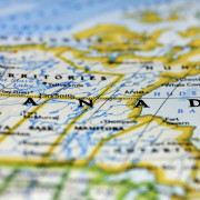
Canada – the birthplace for GIS

Being based in Canada, we were fortunate. A country as large as Canada with a relatively small population needs a way to administer the huge tracts of land very efficiently. Because of this there was a huge legacy of digital map data available.  The only problem: it was a patchwork of uncoordinated bits. It needed to be seamed together from a variety of sources.

We figured the only way to accomplish this massive undertaking was to automate as much as possible. So we did. We created software to do most of the work, and supplemented with skilled labour (GIS technicians) to handle what the automation couldn’t.

Canada’s first digital street map

DMTI Spatial created the first coast-to-coast digital street map for Canada, using the National Topographic Database from Natural Resources Canada as the primary base, supplemented by many other federal, provincial and municipal datasets. We called it CanMap®, and it was the definitive Canadian base map for digital applications.

As our customers became more sophisticated in their use of the technology, there was a need to add more depth and precision to our maps. We added hundreds of layers of data to the street map fabric, including postal geography, electoral geography, 3 dimensional Digital Elevation Model (DEM) data and many others. We built a complete, seamless water layer for Canada, connecting all of the streams, lakes and rivers. For inter-modal transportation, we created a national rail network. For the mobile phone industry we created coast-to-coast clutter mapping for radio propagation analysis – which was used by telecommunications companies to deploy national cellular coverage. We built land use models, assembled demographics and built point of interest data.

And we called it CanMap 2.0

CanMap 2.0 set a new bar for location data excellence in the marketplace.

Others sought us out to build data for them and we built out over 10 million parcel boundaries for the U.S. for First American®.

A history of firsts

A fundamental tool for using location data efficiently is the geocoder. We were not happy with the quality of the available geocoders, so we set out to build our own. Based on our superior knowledge of Canadian geography and Canadian addresses we designed a solution that would make use of the high precision and extensive attribution of the CanMap base. Since Canada is bilingual we created a French-English geocoder, the first in the world.

To add greater precision we developed point level addresses – another first – and incorporated this data into the first point address geocoder.

By the time DMTI Spatial was 10 years old we had a huge catalogue of data products with thousands of variations. We began to combine our technology and data with others in new and different ways to create new hybrid products.

Thinking outside the box

Around this time we came up with a revolutionary new idea – why not combine the digital vector data such as our CanMap street maps with raster imagery – satellite and airborne – to create a new hybrid map/image? We approached Digital Globe and proposed a partnership – a co-branded product we called Satellite Streetview. Digital Globe was so impressed with this product that they started showing it around, and caught the attention of an internet search company. That company was Google™.

Our customers began to ask how were able to combine such large volumes of disparate data into one seamless database. They said that they had similar issues with their own data and wondered if we could help. To solve this problem we repurposed our internal data consolidation software and geocoding software, and Location Hub® was born.

A key innovation was the development and use of a persistent location ID – the Unique Address Identifier (UAID®), as a simple, elegant way to tie all data associated with a particular location to one unambiguous index key.

Based on the success of Location Hub and the UAID we then expanded this capability to embrace the wide world of 3rd party data. If we were able to stamp all incoming data records with a UAID, then any database processed through Location Hub would be instantly integrated with all other datasets processed through the Hub. And so the Location Economics Ecosystem was born.

What’s in store for 2015?

With all this data and processing power available in one software platform, the next logical step was to add analytics to the mix.  DMTI Spatial is getting ready to deploy a new Location-based analytics product this spring. It’s totally new to the spatial visualization field, is incredibly fast and efficient at profiling, requires very little data awareness and manipulation, and is geared to fit multiple verticals without breaking much of a sweat.

Building on our heritage of innovation and creativity, we continue will to help businesses grow through actionable insights uncovered by leveraging location to bring together and analyze a growing world of data. We will continue to make breakthrough products that change the way people use location.

~ John Fisher, Founder – DMTI Spatial

Click here to see how DMTI helps businesses throughout Canada leverage location technology.

Risk management for earthquakes

The Importance of Managing Earthquake Risk

Do your risk management processes consider the risk of Earthquake?

October 16th marked the 7th annual ShakeOut where over 24 million participants worldwide will practice how to drop, cover and hold on at 10:16 a.m. during Great ShakeOut Earthquake Drills.

“ShakeOut BC Day” started in 2011 and this year over 660,000 participants in British Columbia will participate in drills.  The Charlevoix region in Quebec started participating in 2013 and the entire province has joined in for 2014 with over 80,000 participants registered.

Canadian Regions at Risk for Earthquake

Most people would initially think that British Columbia is most at risk when thinking about the risk of earthquakes in Canada.  However, parts of Quebec and Eastern Ontario are also at risk for earthquakes.  At a recent earthquake response seminar held in Toronto by the Catastrophe Response Unit (CRU), Dr. Kristy Tiampo, professor of geophysical modeling methods at Western University’s department of earth sciences in London, Ont. who also works with the Institute for Catastrophic Loss Reduction (ICLR) stated that “Montreal and Ottawa are both at significant risk of ground shaking” and noted that both cities have seen earthquakes that have measured around 6 on the Richter scale.

In an October 2013 report commissioned by the Insurance Bureau of Canada titled “Study of Impact and the Insurance and Economic Cost of a Major Earthquake in British Columbia and Ontario/Québec” two hypothetical earthquakes were modeled by AIR Worldwide.  One off the west coast of British Columbia measuring 9.0 on the Richter scale and one northeast of Quebec City measuring 7.1.  These two hypothetical scenarios would result in a combined estimated total insured losses of over $30 billion.

It is imperative for insurance companies to have a complete and accurate picture of the location of the property that they are insuring in context to the risks that surround that property.  This will allow them to rate the policy correctly and also to determine whether or not they want to assume the risk.  Understanding where the property is in relation to an earthquake zone is very important.  But not only is it important to know if the property itself is at risk, but also knowing where that property is in relation to other items that could be impacted by an earthquake.  For example, what if the property was close to a natural gas pipeline or propane processing facility?  Knowing about these potential risks in isolation is important to the underwriting and rating decision. But, what about when you also factor in earthquake?  An earthquake of a small magnitude may not be enough to cause much damage the property.  But what if it was enough to cause a gas leak, that then lead to a fire and an explosion?  Having this level of information could mean a big difference.

Disaster Risk Management for Insurance Companies

Another factor to consider for insurance companies is the accumulation of risk.  While the risk for the single property may be acceptable, knowing where all your existing policyholders are at the time you underwrite a mortgage and their relation to risks such as earthquake zones will be critical in determining whether you are willing to assume this additional risk or if your exposure is too high.  If there are two major events in a given year, would your exposure be too high and you wouldn’t be able to pay out on all the claims?

In Canada, various forms of location such as postal code boundaries, municipalities and Catastrophe Risk Evaluating and Standardizing Target Accumulations (CRESTA) zones (for earthquakes) are used to determine the accumulation of risk.

As per the ICLR, Canadian reinsurers, insurers and regulators use Catastrophe Risk Evaluating and Standardizing Target Accumulations (CRESTA) zones as the minimum standard for the capture of data and first level of calculation of probable maximum loss (PML).  PML evaluations can influence underwriting decisions, and the amount of reinsurance allowed on a risk can be predicated on the PML valuation.

The original CRESTA zones were established in 1981 and introduced in Canada in 1986.  They have been recently re-worked globally and have been re-launched to the market for 2012/2013.

All businesses can use this information to help define their contingency plans in event of an earthquake. Which of my existing store or branch locations might be impacted?  Where are my employees situated?  How would I deploy resources to help my customers most efficiently?  Where would I situate them?Insurance underwriting and exposure analysis is only one area where this information can be used.  Other examples include:

  • Public Safety departments within governments can use this to build contingency plans for their citizens, determine where they would locate remote relief sites, sites for temporary housing or medical facilities.
  • Telecommunication companies could use this to gain a better understanding of the risks associated with building out infrastructure in various parts of the country

Click here to see how DMTI’s disaster risk management tools help insurance companies effectively plan for every possibility.

Developing Location Intelligence

Transforming Location Intelligence into Profit

Over the next few weeks, this blog series will provide an overview of some of the basic uses of location intelligence (LI) at an enterprise level, its capacity to optimize business processes, and its hierarchy of benefits that impact positively on profitability and competitiveness.

Here’s what readers can expect to learn:

Location Intelligence: Definition and Context

Some progressive organizations are starting to recognize the value of location as an organizing principle. They see how it is embedded in corporate information, and can be applied to current business problems. Through the use of location intelligence technology, these organizations are finding ways to leverage a latent asset.

As a result, telecommunications companies are improving the serviceability of products across their customer base to increase profitability, insurance companies are better understanding risk and pricing to contain costs, utilities are more accurately meeting compliance requirements, and civil authorities are improving threat detection and emergency management capabilities. These are just some of the applications at an enterprise level.

The strategic use of location intelligence is being propelled by several key business drivers, including the need to increase revenue while simultaneously contain or reduce costs. These strategic imperatives form two sides of the profitability equation, which location intelligence is well-suited to solve.

Location intelligence describes the capacity of an entity or organization to use the principles of location to organize, reason, plan and problem solve. It is not defined by the mere presence of location-enabled technology, but moreover by the degree information is enriched by the perspective of location and the successful integration of this information into a process of decision making.

Specifically, location intelligence is the capability to organize and understand complex phenomena through the use of geographic relationships inherent in all information. Applied in a business context, the outcomes are meaningful, actionable and can provide a sustainable competitive advantage. Building location intelligence successfully requires business specific domain knowledge, formal frameworks, and a relentless focus on desired business outcomes. It’s about transforming business processes and creating opportunities.

Dimensions of Location Intelligence

Location intelligence applications are generally industry specific. However, within that framework, uses can be sub-sorted into three sub-categories:

Enterprise decision support: enterprise applications, often vertically focused, that illuminate optimal business strategy. For example, a telecom company consolidating newly acquired customers can identify common customers and determine how to offer services to achieve the greatest value. An insurance company can link geography dependent risk elements such as proximity to a flood zone or density of coverage in specific neighborhoods to better contain costs, and mitigate or more accurately price for risk.

Customer service: applications that facilitate customer service and self-service to improve the overall customer experience.For example, a government agency can more efficiently measure service levels or plan for the distribution of services that are in many cases dependent on variables that change over space, such as household income or number of children. Governments may also be able to better protect constituents by applying location intelligence to existing workflows so as to enhance fraud detection or threat detection capabilities.

Consumer applications: enterprise applications that build loyalty among customers and influence purchasing behaviors. For example, retailers can execute store-specific promotions with more accuracy, and profile and target their markets, resulting in the identification of higher value customers. Or retailers may use location intelligence to augment loyalty program services via internet channels, as in neighbourhood smart store offerings.

Table 1.0 – Use scenarios for location intelligence by industry

Uses of Location Intelligence
Communications & Media Insurance and Finance Government Services
Marketing

  • micro-marketing
  • assessing penetration levels
  • identifying competitive threats
Portfolio Analysis

  • predictive analytics
  • pricing and loss reserving
  • assessing policy saturation
Address Management

  • address validation
  • data cleansing
  • data maintenance
Customer Service

  • pre-sales qualification
  • dispatch efficiencies
  • multi-product eligibility
Marketing Services

  • property-level campaigns
  • neighbourhood context
  • repeat marketing tracking
Information Integration

  • improved data integrity
  • a “one client view”
  • reducing cascading error
Operations

  • customer serviceability
  • cost avoidance
  • network planning
Sustainable Compliance

  • risk assessment
  • improved monitoring
  • compliance auditing & reporting
Entity Authentication

  • fraud detection
  • risk profiling and scoring
  • advanced analytics

Up Next: Challenges, Drivers and the Need for Location Intelligence