With DMTI Spatial, a major Canadian insurance company achieved a 15% reduction in processing time, and a payback period of just 6 months.
Mitigate Risk
Understand concentration risk and exposure to perils such as flooding, earthquakes and crime in real-time. Improve disaster risk management with our easy-to-use data visualization tool.
Accelerate Decision-Making
Expedite your underwriting process, mitigate fraud, and reduce operational costs by equipping your underwriting team with the data they need to make profitable decisions in real-time.
Price with Confidence
Make better informed pricing decisions with the most accurate and robust location-based data on the market.
A sample of our insurance customers:
When disaster strikes, we’ve got you covered.
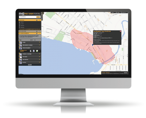
DMTI’s Location Hub® Post Event Service improves disaster risk management and response with advanced insight into the duration, size, impact and number of addresses affected by Canadian events, both natural and man-made.
The Canadian insurance industry has seen over $1 billion in losses in 5 of the past 6 years due to catastrophic events.
Source: Institute for Catastrophic Loss Reduction
Connect. Analyze. Act.
- Stay in-the-know with automatic event notifications, and real-time updates.
- Determine exposure in minutes by viewing event zones on a map.
- Share exposure information quickly and easily with custom event reports.
- Reference historical events when analyzing new potential policies.
Read our Whitepapers
Technology that works for you
Private and Secure
With DMTI, your data is protected by the Azure Trust Center, and is compliant with a wide range of industry-specific regulatory requirements.
Seamless Integration
Our solutions integrate with your existing IT systems seamlessly and securely through DMTI’s web services.
Award-Winning Technology
DMTI Spatial is the proud recipient of the ICTA 2015 Technology of the Year Award.


