Posts

Mitigating Flood Risk with Location Intelligence

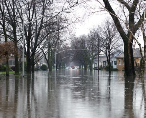
While some weather patterns are predictable, extreme weather events tend to run on their own calendar. Unfortunately, severe weather events have a tendency to cause the most damage and are occurring on a more frequent basis, resulting in a substantial financial impact on Canadian insurers.   According to Catastrophe Indices and Quantification Inc. (CatIQ), in 2018 insured damage from severe weather events across Canada reached a staggering $1.9 billion.

Canada will no doubt continue to experience catastrophic weather events, but insurance professionals have solutions available that can help mitigate risks and reduce the financial impact of these events.  Location Intelligence is an emerging field that provides substantial benefit to the insurance industry – from policy quote and approval processes through to claims management and customer service.

Advances in cloud computing are enabling insurers to migrate traditional geospatial analytics from an off-line manual process to real-time integrated solutions and automated workflows.  Using location as a common point of reference, users are able to connect policy, property, claims and third-party data together to gain insight into the property and the surrounding area – allowing them to quickly analyze, visualize and assess property risk.

One common use case is the real-time, automated analysis of a proposed policy vs flood zones, earthquake zones and other potential perils.  Getting a high precision view of where a property sits versus identified risks, allows for more accurate assessments. The availability of real-time location data offers two primary benefits.  The first is increased productivity, delivered by automating assessments and consolidating the output on one screen so that agents can make better faster decisions.  The second is proper pricing for the risk scenarios being proposed.  The key to enabling these benefits is to empower the end user with information in real time.

While an agent is assessing the risk of a potential property, location data can answer a multitude of questions: Is this property exposed to a 1/20, 1/100, 1/200, or 1/1500 year flood event? What are the types and magnitude of historical claims in the surrounding area? Is my accumulation risk too high, or am I able to take on any more policies in this area? Are the current policies priced to cover identified risk? The answers to these questions are imperative when an insurer is trying to accurately calculate total risk exposure from perils and flooding, and accurately quote the policy in a timely manner.

While severe weather events and flooding will continue to present risks to Canadian insurers, access to real-time location data, including flood information, can enable insurers to make more informed decisions during the approval process. While the weather will continue to be unpredictable, location intelligence is a powerful tool to protect your bottom line.

To learn more read our White Paper:  Mitigating Risk with Location Intelligence


Additional Reading:

Top 3 Ways Location Intelligence Empowers Underwriters


Customer Experience Location Intelligence and Insurance

5 Hidden Data Points Insurance Companies Can Use to Improve their Customer Experience

Creating exceptional customer experience is becoming a top priority for many insurance providers as an essential way of differentiating themselves in a fiercely competitive marketplace. If you and your competitor offer similar pricing, but your competitor provides a better customer experience, who do you think will land the customer?

Location data offers actionable information that insurance providers can use to deliver high quality customer experiences at every touch point. Interested in using data to outpace your competition by offering stronger customer experiences? Check out these 5 hidden data points:

1) Accurate Postal Codes  

You want to ensure you’re offering the most accurate quotes possible when customers come to you seeking coverage. If you’re assessing risk based on postal codes, you aren’t working off of the most accurate location information, and this will be reflected in your pricing. Flooding and earthquakes, for example, don’t stop at the postal code boundary. It is more accurate to assess properties based on latitude, longitude, and elevation to truly understand risk.

Using a location intelligence platform like DMTI’s Location Hub, insurers can better identify and rate risks for properties of interest. Actionable information ensures underwriters make data-backed decisions based on the specific locations being reviewed. You get real-time, high precision geocoding delivered with trusted industry standards, and customers get pricing they can trust.

2) True Risk Concentration

You cannot gain a true understanding of a property’s overall risk probability if you examine risks in silos. Location intelligence offers the ability to review total concentration of risk, such as flood, fire, and other natural hazards, and assess likelihood of any of these occurring, as well as how close the property is to emergency services.

Here’s how this improves your customer’s experience. Aside from providing customers with fair, accurate pricing, you also have a comprehensive understanding of their exact insurance needs, including needs they may not realize they have. For example, a customer coming to you for property insurance may not realize they also require coverage for wildfire or flooding. Using location intelligence, you’ve got the data to show customers what they need, making them feel confident in your services and completely protected by the coverage you offer.

3) Reduce Processing

Time Average processing time for quotes and claims is an essential data point every insurance provider must be aware of. Most people are accustomed to immediate gratification, and staying competitive in the insurance industry requires providers to deliver information quickly.

Leveraging the right digital tools is the key to tracking and reducing processing time. Location intelligence easily feeds into platforms that automate the underwriting and claims process according to your company’s rules and guidelines.

4) Customer Information

Location Intelligence platforms enable customer data to be seamlessly integrated, allowing you to autofill information and limit the number of manual inputs required when generating quotes. Automation of personal information reduces costs for you, while providing customers with a better digital experience. Location intelligence also allows you to review customer claims patterns for real time data-based decision making throughout the underwriting process.

5) Complete Customer Portfolios

Instant access to customers’ portfolios provides an overview of data revealing areas where your insurance company could offer additional services. For example, if you’re using a location intelligence platform, you’ll be able to see all properties owned by a customer that may be covered by other insurance providers. With complete property information paired with hazard data, you’ll also be able to see if your customer has adequate coverage to fully protect their assets. This data allows you to provide a great experience for customers because you enter conversations prepared with complete information and options to provide better rates and coverage than your competition.

Click here to learn more.


Additional Reading:


Portfolio Items